 Dead MMO
Map
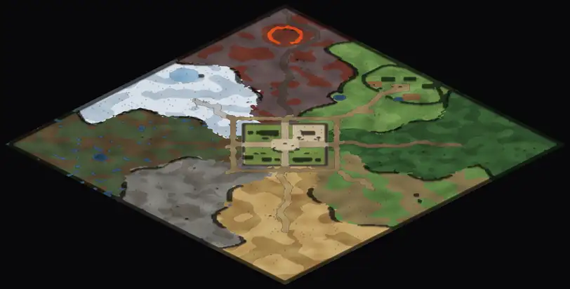
The Reach as the Guild's surveyors drew it: the overworld around Emberhold, the Quietlands past the roads, and the Deep Maze below the Ashen Wastes. Drag to look around, use the wheel or pinch to zoom, and tap a marker to read it. Every spot is drawn from the game's own maps, so it matches what you will find.
Legend
Markers
- Waystone: discover it once, then travel back from any other
- Rest camp: no monsters, a fire to rest and cook by
- Quest giver
- Merchant
- Banker
- Crafting station
- Guild and faction services
- Gate, portal or dungeon entrance
- World boss
- Elite monster
- Monster spawn
- The Pit (PvP arena)
- Sacred den of a faction
- Border stone
- Watchtower
- Faction war camp
- House for rent
- Guild Allotment (farm bed)
- Stall square (player trade)
- Chest (the Deep Maze)
Ground
- Open ground, in each zone's own colour
- Darker ground: trees, rocks, buildings and walls you cannot walk through
- Roads and streets
- Water (and the Grey Sea round the Quietlands)
- A warm tint marks safe towns
Gathering
 Mining nodes (the icon is what they give)
 Woodcutting nodes (the icon is what they give)
 Herbalism nodes (the icon is what they give)
Factions
- The Crownless
- The Saltgrey Undermarket
- The Lamplighters' Compact
Coordinates are the game's tile numbers (x, y). The address bar keeps the spot you are looking at, so you can send it to a friend: for example the Pit. Monsters roam a little round their marks; the Deep Maze is a PvP zone for level 30.